Showing posts with label UNIT 8: THE RELIEF OF SPAIN. Show all posts

Wednesday, May 22, 2013

SCIENCE DISPLAY UNIT 8

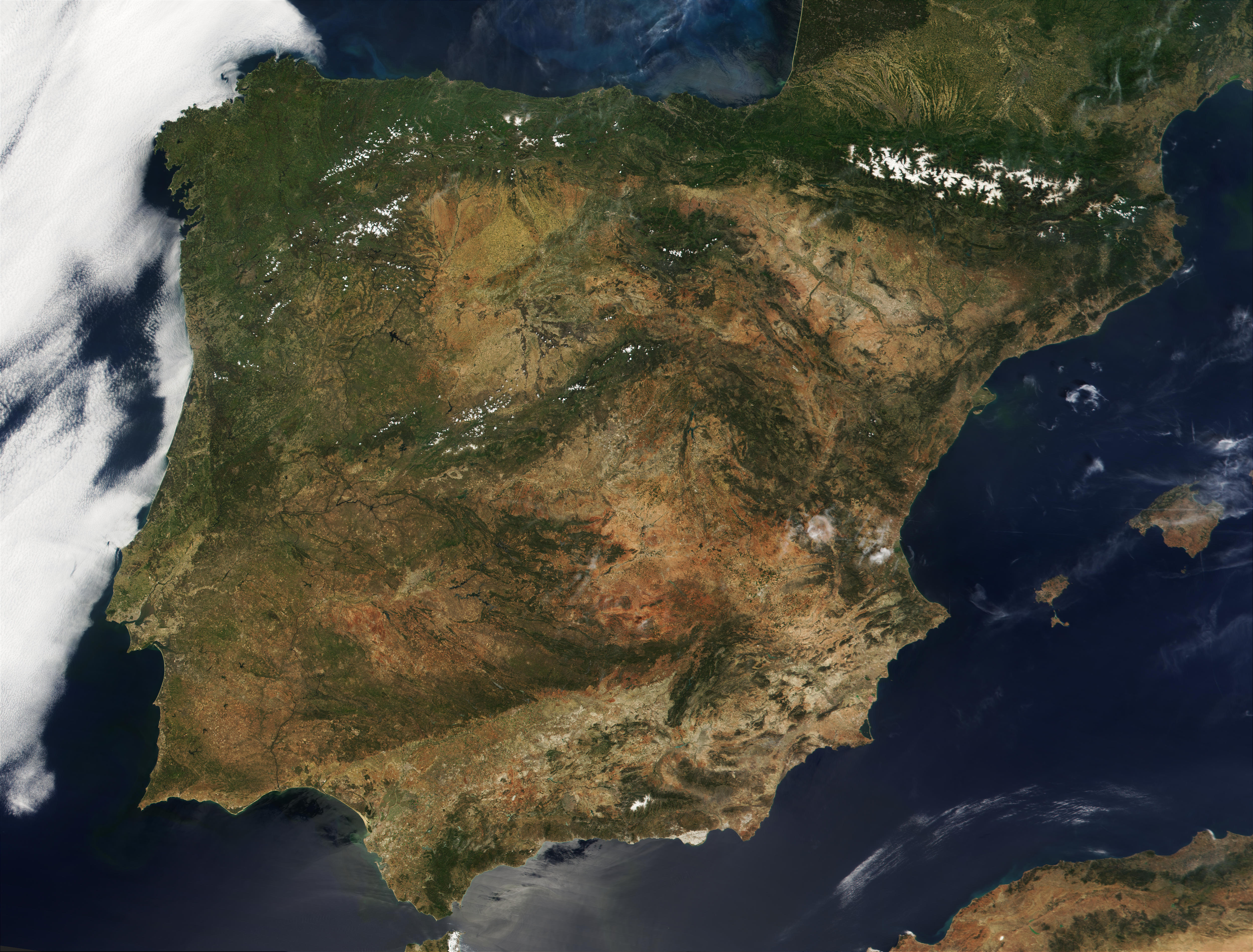
HAVE YOU SEEN OUR SCIENCE DISPLAY?
It is full of maps, there is no room for more. You can find diagrams, maps made of plasticine, clay, paper...  big posters, small posters...It is great way to study the relief of Spain.


Gifs ANimados Flechas (120)If you can not visit our school ...why don't you click on each project on the left of the blog?

Friday, May 17, 2013

Make a summary of the unit and check the contents.

Answer these exercises.

You can see Spain and an island from a satellite.

Practise with some exercises about the landforms, the coastline and the rivers of Spain.
Coastline

Coastline 2


Rivers


Rivers 2


Rivers 3


Rivers 4


Crossword


More activities
Test

Learn more about this unit.


Rivers

Ebro: Longest river in Spain (900 km) flows through Zaragoza.

Duero: This golden river starts in the autonomous region of Castile and Leon and flows through Portugal in the Atlantic Ocean.

Tagus: This river flows into the Atlantic Ocean at Lisbon. The river flows through the city of Toledo and is about 1000 kilometers long.

Guadiana: Flows through the cities of Merida and Badajoz (Extremadura), and forms downstream the border between Portugal and Spain.

Guadalquivir: Andalusian river flows through Córdoba and Seville and is about 600 kilometers long.

Júcar: Passes through the province of Cuenca, Albacete and Valencia. Ends after 500 km in the Mediterranean sea.

Segura: A slightly smaller river that flows through the city Murcia. The river is known for its floods.

Northern rivers Miño and Sil: River in Galicia with a length of 340 kilometers.


Southern rivers: including several short rivers south of the Sierra Nevada.


DUERO EBRO TAGUS JUCAR Catalian rivers SEGURA GUADALQUIVIR Southern rivers GUADIANA Northern rivers